Margam Mountain
010 Mynydd Margam Forest
HLCA 010 Mynydd Margam Forest
Extensive 20th century forestry plantation (Ancient and other broadleafed woodland); formerly open mountain and enclosed land; former monastic land: grange and chapel; relict multi-period archaeological landscape: prehistoric, medieval, and post-medieval settlement (loose dispersed settlement pattern) and fields, prehistoric funerary and ritual with a prehistoric defensive element; prehistoric, medieval and post-medieval communications corridor; accumulation of blanket peat with environmental potential; industrial archaeological features. Back to Map
Historic Background
The historic landscape area of Mynydd Margam Forest comprises an area of former open mountain and enclosed valleys associated with the Cistercian Abbey of Margam, specifically Hafod-y-Porth Grange (SS 80128 8986), and that of Cryke Grange and Margam Abbey itself, the latter outside the character area boundary. The area retains important remains of a grange and associated chapel at Hafod (Hafod-y-Porth). Following the dissolution of the monasteries the monastic properties of the area became part of the Margam Estate.
Historic Landscape Characteristics
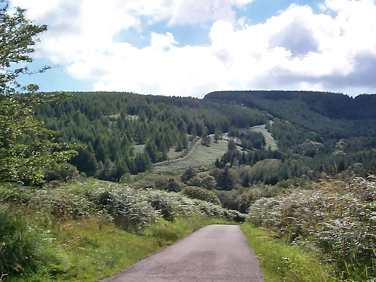
Mynydd Margam Forest is chiefly characterised by extensive 20th century forestry plantation. The area, now largely masked by modern forestry, encompasses a mixture of formerly unenclosed and evolved/irregular and varied enclosure (Figure 11a) detailed on estate plans of 1814 and the 1st edition OS 6" maps of the 1884/5. The unenclosed areas, formerly open mountain are Mynydd Margam, itself (Figure 11a: HLCA 010C) and Mynydd Bach (Figure 11a: HLCA 010A); the areas of enclosed land (Figure 11a: HLCA 010B and D).
The area is also characterised by tracts of Ancient Woodland, notably within the valleys which cut the flanks of Mynydd Margam, notably Cwm Maelog (partly replanted with conifers in 1858), Nant Cwm-y-Garn, and Cwm Nant-y-Glo, with further broadleafed woodland within Nant Cwm Wernderi (1st edition OS 1884). The higher ground, formerly open heath was planted under the auspices of the Forestry Commission following World War II. The area, part of the extensive monastic lands associated with Margam Abbey and farmed from granges at Hafod (Hafod-y-Porth) and Cryke at Margam itself, was formerly open mountain grazing/grouse moor with adjacent areas of enclosed, but marginal land.
The most important characteristic of the area is as a relict archaeological landscape of multiperiod date, with remains dating from the prehistoric, medieval, and post-medieval period, primarily: settlement and fields, prehistoric funerary and ritual, and prehistoric military features. Principal sites include Bronze Age cairns as at Ergyd Uchaf (SAM Gm 159) and at the head of Cwm Cynffig, ie a ring cairn, the site of the Bodvoc stone (SAM Gm 443) and Twmpath Diwlith (PRN 00754w), and the scheduled prehistoric site, an oval enclosure known as the 'Danish Camp' (SAM Gm 056). The area is also significant as an early and well-established communication corridor, based on ridgeway routes, which have been used from the prehistoric period to, in some cases, up to the present day. The most important of these routes is Ffordd-y-gyfraith, (also known as Cefn Ffordd), which runs along the ridge of Mynydd Margam via Rhyd Blaen-y-cwm and south east towards Mynydd Baedan (RCAHMW 1976, Vol I, II and III; Rees 1932; Yates 1799 map). It is considered that impact of clearance and climatic change towards the end of the Bronze Age resulted in environmental conditions conducive to the formation of blanket peat; this affected the dissected plateaux of Mynydd Margam as elsewhere in the upland Glamorgan (Caseldine 1990); there is some potential for survival of environmental and other indicators associated with the Bronze Age and earlier landscape. Afforestation with its associated drainage, during the latter half of the 20th century may have had a detrimental impact on the survival of environmental material.
Archaeological features throughout the area are otherwise predominantly associated with either post-medieval upland agriculture and subsistence practice, typified by farms, farmsteads, barns, sheepfolds, and at least one potential pillow mound, or associated with industrial use; the latter include quarries, gravel pits, collieries (all old coal levels depicted on the 2nd edition OS map of 1900) and charcoal burning sites. The area is also associated with minor water supply. Boundary stones, delineating post-medieval (or even earlier) land divisions, are also numerous landscape features.
The visible settlement pattern of the area, while essentially post-medieval in its final phase, comprising a loose dispersed scatter of farmhouses and cottages, including Blaen-Maelwg, Llan Ton-y-Groes, and Nant-y-Glo farmsteads, and farm buildings at Wernderi and Hafod, is considered likely to have medieval precursors.