Margam Mountain
009 Cwm Dyffryn and Cwm Farteg Railway Corridor
HLCA 009 Cwm Dyffryn and Cwm Farteg Railway Corridor
Industrial/public railway/tramroad corridor; industrial railside settlement (terraced housing and large cemetery); former agri-industrial function. Back to Map
Historic Background
The historic landscape area of Cwm Dyffryn and Cwm Farteg Railway Corridor reflects the emerging industrialisation of the area from the medieval period. Goytre is known to have been the site of 'Fredulles Mills' (water and fulling) on the Ffrwdwyllt, associated with the monastic grange of Hafod-y-Porth (HLCA010), one of which was perhaps the 'New Mill' of 1520. These may have been located near the site of the Dyffryn Mill (corn) depicted on the 1st edition OS map of 1884. Following the dissolution, the area had formerly been monastic land farmed from the grange of Hafod-y-Porth, was transferred along with other monastic property to the Margam estate.
Historic Landscape Characteristics
Cwm Dyffryn and Cwm Farteg Railway Corridor is characterised chiefly as a communications route, primarily the route of the now disused line of the Port Talbot Railway (PTR) between Port Talbot's Dyffryn Junction and Maesteg, via Bryn, built c. 1898. The area also encompasses the route of the earlier Goetre Level Tramroad (1st edition OS 1885) towards Margam Copper Works, west of the area. Other transport features include minor post-medieval road, lanes and tracks.
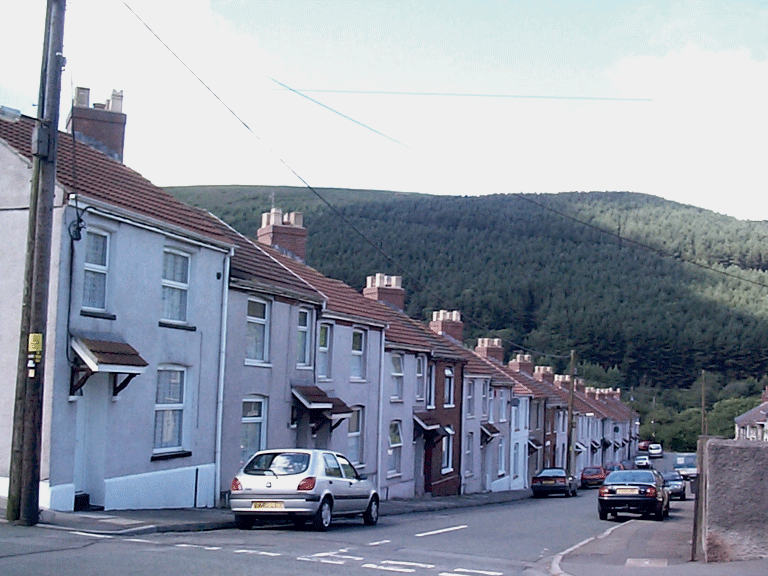
Another major characteristic of the area are early 20th century industrial railside settlements, namely at Goetre (East Street and Emroch Street) and at Bryn (Station Terrace and Gallt-y-cwm Terrace); here the earlier 19th century industrial settlement associated with the Bryn Colliery and Tramway was eventually expanded around the later railway (PTR) station. The industrial settlement (early 20th century) is characterised by linear ribbon and grid street patterns; the earliest characteristic building type being the terraced house, those at Goetre (ie East Street and Emroch Street) have chimneys set at an angle to the street frontage. Later 20th century social housing predominates. A significant visual feature at Goetre is its large cemetery (constructed according to plans finalised in 1915). The area also contains industrial remains of the 19th century, such as the disused Goetre Level (coal; 1st edition OS 1885).