Margam Mountain
008 Margam Village
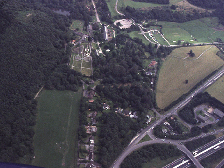
HLCA 008 Margam Village
Post-medieval estate village with 20th century ribbon addition; post-medieval (17th-19th century) vernacular buildings and 20th century suburban residences. Back to Map
Historic Background
The historic landscape area of Margam Village comprises the small hamlet with early post-medieval origins, originally named Pound, after the enclosure where stray sheep from Mynydd Margam were held prior to being sold at Taibach market. The main estate village associated with Margam Park, however, lay slightly further to the north at Groes, constructed to rehouse villagers from the earlier post-medieval village within the confines of Margam Park demolished during the 1830s and 40s. Groes, which had been laid-out by Haycock, was in turn entirely removed by the construction of the M4 motorway during the latter half of the 20th century.
Historic Landscape Characteristics
Margam Village is characterised as a residential area, which has developed from the estate village associated with Margam Abbey/Margam Castle. The original settlement was a loose cluster of post-medieval farms and cottages, in the local vernacular/estate tradition. Characteristic features of the historic landscape area are post-medieval (17th-19th century) vernacular buildings, such as the Old Vicarage (formerly Margam Cottage), Margam (Listed grade II; early 19th century), Margam Cottage (formerly Cwm Cottage), a post-medieval house (Listed grade II; 1693, direct entry, end chimney, hall, outer room, formerly thatched, farm buildings), and Grove Cottages (Listed grade II; mid-late 19th century). During the 20th century, ribbon development of suburban residences augmented the residential nature of the area. Other characteristic features include gardens/cultivation plots.