Margam Mountain
006 Eglwys Nunydd and Cwrt-y-defaid
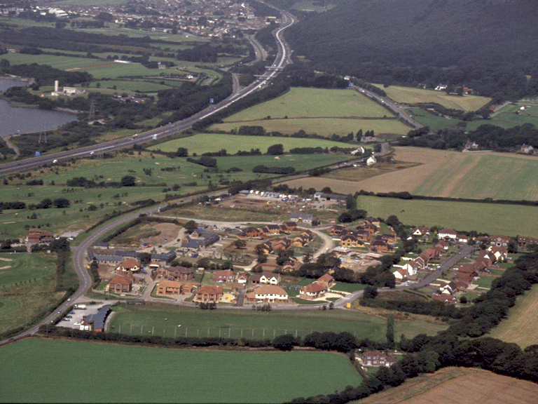
HLCA 006 Eglwys Nunydd and Cwrt-y-defaid
Agricultural and residential area with important historic associations; important ecclesiastic landscape with early origins; post-medieval fieldscape; relict archaeological landscape of early medieval/medieval/post-medieval settlement; interesting post-medieval vernacular buildings; buried archaeological remains in the form of finds (including medieval inscribed stones) and parch/crop marks; important communication corridor (Roman and later) . Back to Map
Historic Background
The historic landscape area of Eglwys Nunydd and Cwrt-y-defaid is part of the Margam estate adjacent to the main transport corridor in the area, ie Water Street, a coastal route in use since the Roman period, between Neath (Nidum) and Cardiff and ultimately Caerleon. The area is an ecclesiastic landscape of some importance being the site of an early medieval monastic settlement associated with St Non, Mother of St David in the vicinity of the post-medieval farmstead of Eglwys Nunydd; many of the inscribed stones relocated to the Museum at Margam originated in the area. The ecclesiastic importance of the area continued under the Cistercian Abbey of Margam, when the area was farmed from the medieval monastic grange of Llanfugeilydd, Cwrt-y-defaid or Sheeps Grange with its medieval cemetery.
Post-medieval features are an important element in today's landscape, and comprise agricultural enclosure and settlement. Apart from the remains of Eglwys Nynydd farm, other notable post-medieval settlements include Old Park, a late 17th century L-plan two-storey house, with a kitchen at the outer end of each range and varied stone doorways, including one with an entablature on brackets. The house contains a late 17th century staircase said to have originated from the demolished Margam Abbey mansion
Historic Landscape Characteristics
Eglwys Nunydd and Cwrt-y-defaid, set on the low-lying coastal fringe, is characterised as an agricultural and residential area with important historic associations. The area is an ecclesiastic landscape of some importance. The area of the post-medieval farmstead of Eglwys Nunydd is known to be the site of an early medieval monastic settlement associated with St Non, Mother of St David. The ecclesiastic importance of the area is reinforced by the existence of a medieval monastic grange belonging to the Cistercian Abbey of Margam.
The strongest characteristic of the area today lies in its varied post-medieval fieldscape of both irregular/evolved and regular large fields interspersed with occasional coppices or coverts of broad-leafed woodland. While the area's relict archaeological landscape of early medieval/medieval settlement is of interest, the standing post-medieval agricultural buildings are now the most characteristic visual element in the landscape. The area contains a number of post-medieval vernacular buildings including the Tithe barn, outbuildings and farmhouse at Eglwys Nunydd, the four-unit, central stair-passage house of Old Park (17th century, listed grade II), the barn at Kenfig House, and the 18th century Cwrt-y-defaid Cottages, for example.
Less visible but nonetheless important characteristics of the area are buried archaeological remains, ranging from finds (including medieval inscribed stones) to parch/crop marks. The area has also formed an important transport/communication corridor since the prehistoric period to the present day, and is bounded by the B4283, route of the medieval Water Street (also known as Heol y Sheet, Heol Las, etc), and the current A48 main road.
A recent addition to the built character of the area is the dense clustered or nucleated planned 'executive-style' settlement based around converted post-medieval farmstead of Eglwys Nunydd.