Margam Mountain
004 Mynydd Brombil and Ergyd Isaf
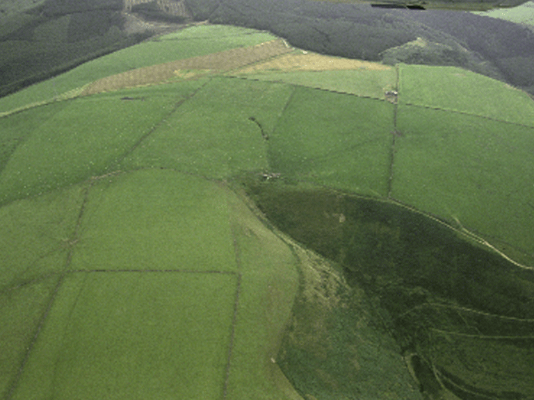
HLCA 004 Mynydd Brombil and Ergyd Isaf
Enclosed upland, primarily post-medieval enclosure; deserted medieval/post-medieval upland settlement landscape with relict prehistoric funerary and ritual features. Back to Map
Historic Background
The historic landscape area of Mynydd Brombil and Ergyd Isaf comprises an area of enclosed upland part of the Margam Abbey Estate, progressively enclosed from the 18th century and currently dominated by large regular fields. The area has a number of relict features chiefly associated with medieval/post-medieval agricultural settlement ranging from pillow mounds to house (hut) platforms, but also including round barrows, burial mounds of Bronze Age date.
Historic Landscape Characteristics
Mynydd Brombil and Ergyd Isaf is characterised as an area of upland/mountain, part of the former extensive upland holdings associated with Margam, which saw progressive enclosure from at least the 18th century. The area is currently set down to dry pasture and arable fodder and characterised by medium and large regular enclosures, mostly of twentieth century date. The main landscape importance of the area is as a relict archaeological landscape of deserted medieval/post-medieval upland settlement (PRN 01994w; NPRNs 15,371; 54,460; and 300,892) associated with field systems and other agricultural features, including pillow mounds. Settlement comprises medieval platform houses; these include a group of up to 8 house platforms (NPRN 300,892), two enclosures and a group of between 3 and 5 ditched pillow mounds. The area also has a small, but important prehistoric funerary and ritual element, two Bronze Age Cairns, or round barrows (SAM Gm 160) at Ergyd Isaf, the highest point within the area at 260m.