Llancarfan
009 Greendown
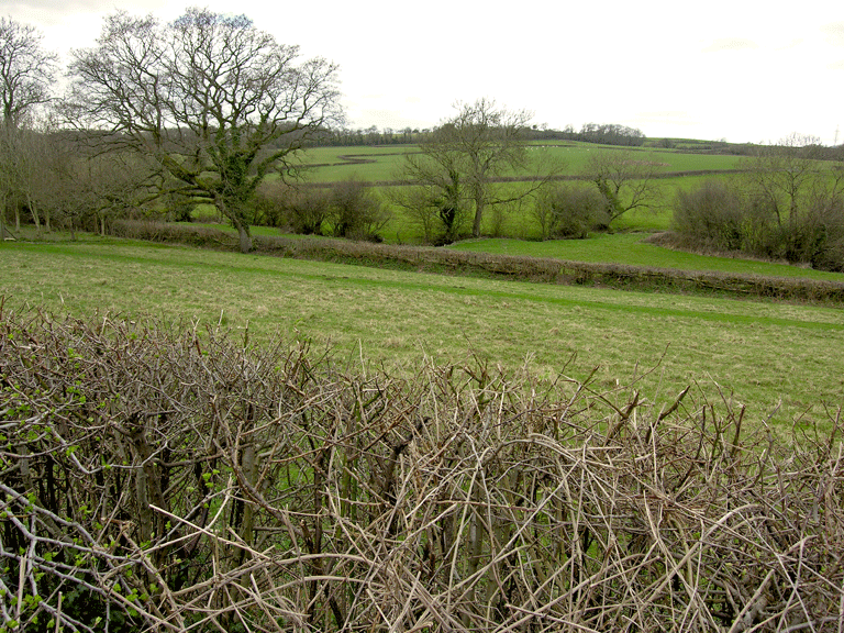
HLCA 009 Greendown
Ecclesiastical and historic associations; medieval/post medieval field system; traditional boundaries; agri-industrial features. Back to Map
Historic Background
The historic landscape area of Greendown represents an area considered to be part of former grange land known as' Greendona Grange'. It is bounded to the west by Liege Castle (HLCA 011) and Middle Llancarfan Valley (HLCA 008) character areas and by an area of woodland and unimproved scrubland furze to the east. To the south of the area is Nant Whitton. The area formed part of the parish of Bonvilston and is recorded on the 1839 Bonvilston tithe apportionment as fields owned by Robert Savayrs and Thomas Edwards and as 'Down Mawr' (Great Down), in the ownership of Llewellyn Trehearne and Thomas Meezy.
There is a strong religious association in the area from as early as 1205, with references to various grants of land awarded to monks at Bonvilston. Later a grange is specifically mentioned at Bonvilston in a papal bull from 1261; interestingly though, by 1291 in papal taxation records reference is only made to annual rent and 'work done by the nativi' and not relating to any grange (RCAHMW 1982).
No definite location for the aforementioned grange has been determined as documentary sources are limited in detail. Two sites have been considered as likely locations by the Royal Commission (RCHAMW 1982, 293): both lie outside of this character area. The first is to the northwest and is a low lying rectangular earthwork within HLCA011 noted on the OS map as a former 'Chapel and Graveyard' (PRN 00362s) associated with Liege Castle; the second is a ringwork (PRN 00798s) that may have also been the seat for Simon de Bonville, the presumed Norman founder of Bonvilston.
The importance of the streams which cross this area are also a consideration in the locating of the grange as their courses are likely to have been important in defining the grange boundary from at least the 13th century: it would appear that the extent of the grange land would have been larger than the current character area, extending north and east to Bonvilston (Williams 1990).
The form of the fieldscape within this character area has been maintained largely as it existed on the 1st edition OS map. The only settlement within the character area is the farmstead of Greendown (now 'Meadowbank') with its associated agricultural buildings set within a sub-rectangular enclosure divided in two with an orchard to the north and the farmstead to the south; the farmstead is shown on the 1st - 3rd edition OS maps as a rectilinear building fronting and west of the lane with attached smaller irregular range to the rear (west), and a rectangular garden to the front. A detached linear range of outbuildings including a barn and a detached (dual) sty and rectangular yard to the rear is located on the opposite side of the lane to the west again fronting the lane, though slightly set back; further to the south is another detached building, and further south a quarry (under scrub) and limekiln (old on the 1st edition OS map). Little change is identifiable until the latter part of the 20th century, when the settlement is expanded and the farm converted to residential use. The quarry has been built over and is presently the site of 'The Paddocks' and 'Wild Meadow Cottage'. Minor subdivision of the enclosures closest to the new dwellings to create gardens and small paddocks also dates from this period.
Historic Landscape Characteristics
Greendown is characterised largely by its fieldscape and also by its historical and religious associations. The key characteristics of this fieldscape are medium and small irregular fields with boundaries formed primarily of hedgerows with some distinctive trees.
There has been some amalgamation of fields in the north of the character area: to the south of the modern settlement of Greendown the opposite is true and there has been subdivision of fields. The characteristic field system described above includes a distinctive irregular diamond-shaped field in the northeast that does not fit with the pattern previously described. This field may be the site of a croft or habitation, and could relate to the former grange in addition to those identified by the Royal Commission. A slightly irregular curvilinear boundary encloses the general area of settlement on the east from Greendown farm south, and separates it from the agricultural fieldscape beyond. Further study of the field boundaries in this area may provide useful data on enclosure development and even allow the potential location of the monastic grange to be identified. The location of the actual grange is currently only speculation; however, aerial photography has allowed the identification of a crop mark (NPRN 309,018) just south of the modern settlement of Greendown, again within the curvilinear boundary, and this might repay further survey.
The primary characteristic, which has to a great extent defined the boundaries of this character area, is its historical religious associations. It forms part of the former Greendown grange lands, which were variously owned by a number of gentry, lordships and abbeys throughout the medieval and post-medieval periods including Hugh de Raelegh who gifted his grange of 'Greendona' to Margam Abbey at some point around 1161 (Williams 1990). Sir John St. John acquired under single ownership this character area, HLCA 009, and the Manor of Bonvilston in 1541, thereby establishing a strong historical link between the two (RCHAMW 1982).
The area's post-medieval buildings are few and comprise 'Meadowbank', which appears to be the surviving post-medieval farmstead of Greendown (from 1st - 3rd edition OS maps), with, on the opposite side of the road, its now converted outbuildings, a linear stone-built range which included a barn: this element preserved in the name 'Ysguboren House'. The farmstead has rendered elevations with sash windows under a slate roof. Apart from Greendown Farm the settlement in the area has remained small-scale and is of late 20th century date. The boundaries around and adjacent to the modern settlement at Greendown are a mortared wall type.
Other boundaries that exist within the area include physical boundaries such as routes of water supply, for example the Nant Whitton to the south, the Middle Llancarfan Valley to the west and woodland/scrub to the east. Other longstanding administrative boundaries include former grange land and the later Bonvilston parish boundaries; the lands previously held by Liege Castle also formed a boundary to this area in the west.
Additionally other minor characteristics relate to minor industrial features such as limekilns and a quarry extraction site. These were used for the production of lime for use in agriculture as well as for building. These features are documented in the landscape from at least the 1st edition OS map however their present state of survival is unknown.