Merthyr Mawr, Kenfig and Margam Burrows
006 River Kenfig and Llanmihangel
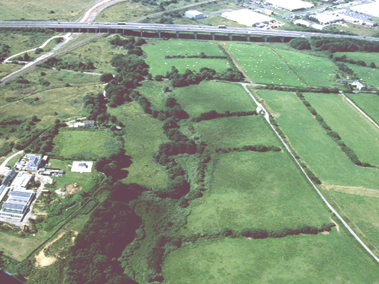
HLCA 006 River Kenfig and Llanmihangel
Agricultural landscape of post-medieval settlement/fields with surviving relict medieval features associated principally with monastic grange of Llanmihangel (St Michael's); distinctive field boundaries; Ancient and other broadleafed woodland; post-medieval vernacular buildings; historic associations.Back to Map
Historic Background
The historic landscape area of River Kenfig and Llanmihangel encompasses the lower reaches of the Kenfig river valley. The area essentially comprises land belonging to the post-medieval farms of Marlas and Llanmihangel.
During the medieval period the area formed the nucleus of Llanmihangel or St Michael's Grange associated with the Cistercian Abbey of Margam, referred to in 13th and 14th century documents as having both arable and meadow land, a curtilage, a watermill and a fulling mill. Remains include the possible site of the grange chapel, indicated by place-name evidence and fragments of a 10th/11th century cross (SAM Gm 345) and dressed window stone, a possible associated rubble-built tithe barn.
The post-medieval farm of Llanmihangel, a 2-storey rubble-built farmhouse with early 17th century details, including mullioned windows, appears to be situated on the site of the main grange. To the south is Llanmihangel Corn Mill (Listed grade 2*), early 19th century 3-storey mill structure probably on the site of earlier mill associated with Margam Abbey, referred to 1291; the site retains a scheduled leat and dam (SAM Gm 449), part of the medieval mill complex.
Marlas (Marlais) farm (Listed grade 2), a regional house with internal chimney, lobby entry, fireplace stairs and sunk chamfered windows is thought in part to date to the 16th century, (the dwelling of Richard ap Thomas in 1543); the earliest surviving parts of the building was based around a courtyard with its entrance to the south. Part of the building had been in long use as a malthouse and retains a large corbelled chimney of early date. Other early features include stone stairs from the western range to the courtyard and Tudor windows and doorways.
Historic Landscape Characteristics
River Kenfig and Llanmihangel is primarily a post-medieval agricultural landscape, though prehistoric find scatters indicate earlier use and development, now superseded. The landscape is characterised essentially by post-medieval settlement/fields with surviving relict medieval features associated with use as a monastic grange of Llanmihangel (St Michael's) associated with Margam Abbey with medieval chapel, tithe barn and mill site among identified remains. The agricultural landscape is characterised by an evolved, though fairly regular field pattern of moderate to large fields with areas of surviving medieval ridge and furrow and distinctive field boundaries. Ancient and other broadleafed woodland and areas of unmanaged scrub are evident in the area. The area's settlement has a loose dispersed pattern of farms/cottages with good examples of post-medieval vernacular buildings. Locally based industrial features associated with agriculture, essentially milling (corn and fulling) date back to the medieval period and the area's monastic past. The area is also characterised by minor communications, ie footpaths, tracks, lanes both winding and straight.