Merthyr Mawr, Kenfig and Margam Burrows
003 Margam Burrows
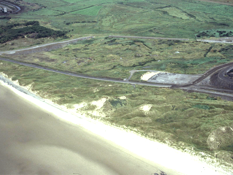
HLCA 003 Margam Burrows
Coastal sand dunes, with recent industrial intrusion; medieval warren; 20th century military/defensive landscape. Back to Map
Historic Background
The historic landscape area of Margam Burrowscomprises an area of coastal sand dunes, north of the Kenfig River/Afon Cynffig within the ecclesiastical parish of Margam, and west of the railway corridor HLCA 018. The area appears to have been used as a rabbit warren during the medieval period, with references testament to a Warren known as the Berwes Warren. The area contains a number of minor footpaths and tracks known to have existed during the 19th century allowing access to farms (eg Morfa Bach and Morfa Mawr) and industrial sites (eg Morfa Colliery with its associated settlement of Pit Row) outside the area along the coastal fringe.
More recently during World War II, the area was used for military/defensive purposes with references to a heavy AA battery being located in the area.
Historic Landscape Characteristics
Margam Burrows/Twyni Margam is characterised as an area of coastal sand dunes, partly tipped over with recent waste from the adjacent steel works. Beyond references to use of the area as a rabbit warren during the medieval period and to features associated with defence during World War II, direct historical characteristics are generally elusive.