Gower
072 Ilston
HLCA072 Ilston
Post-medieval/medieval agricultural and settlement landscape: varied fieldscape; woodland; nucleated settlement; medieval farmsteads; post-medieval industrial features; historical religious associations; and communication routes. Back to Map
Historic Background
The historic landscape area of Ilston is the extent of enclosed land of Ilston; to the east of the pale of Parc-le-Breos and north of Kittle around the upper reaches of Ilston Cwm. the valley of Pennard Pill stream. The northern and western boundaries are formed by unenclosed common land and Swansea Airport.
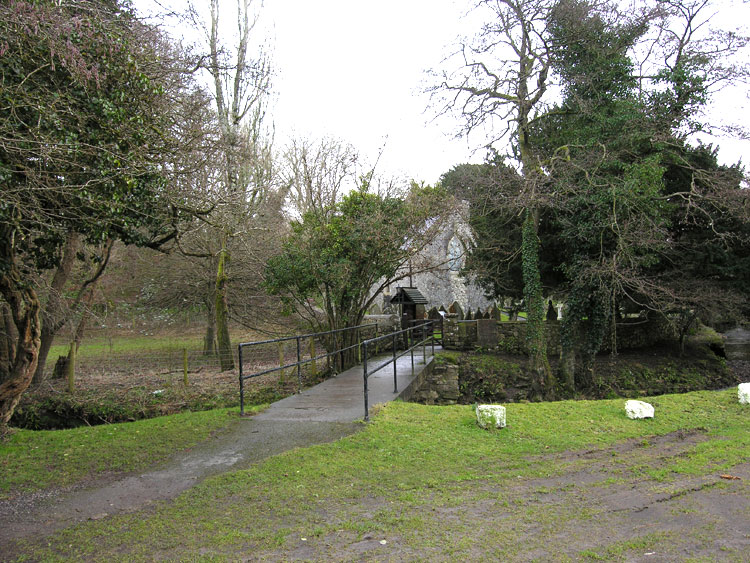
The earliest recorded archaeology for the area dates from the Roman period; finds (00243w; 02270w) include a burial (02779w) with associated coin hoard of ninety-one coins dated to the third century. No further evidence of settlement in the area has been found until perhaps the 6th century when St Illtyd's church is reputed to have been founded. It is argued that Ilston was associated with the Lann Cingualan of the Llandaff charters as the boundary description is a good match for the area (Morgan 1899), however this is not widely accepted (Evans 1998). Despite its early dedicated saint's name, the earliest mention of a church (00247w) at Ilston is in 1119, referred to as 'Llan Illdut', the full Welsh name of the village being Llanilltyd Ferwallt, translating as St Illtyd near Fairwood (Orrin 1979).
From at least the thirteenth century, Ilston comprised three small holdings in Gower Anglicana situated between the fees of Lunnon and Kittle and Fairwood Common, these holdings were most likely Ilston itself, Bryn-afel and Courthouse judging by their positions on the manorial boundaries map by Seyler (1924). The present church (00247w; 400050; LB 11524 II*) dates from this period and in 1221 John de Breos donated it to the Knights Hospitallers of St. John of Jerusalem; this remained in their patronage until it passed to the crown with the dissolution in 1540 (Orrin 1979). By this time the parish of Ilston covered a larger area than this HLCA, incorporating Lunnon (part of Parc le Breos) and Fairwood. Hamlets within the parish mentioned by Rice Merrick that fall within this landscape area are Moorhouse and Bryn-afel and also the 'ancient' dwelling at Courthouse (00245w; 18421), with the settlement of Ilston at the centre. Merrick notes that Courthouse was owned by Thomas ap Owen son of Henry ap Owen, but previously by the Delabere family; it is known that Morgan ap Owen bought Courthouse and associated lands in 1441 (Nield 1981). The Bowen family (as the Owen's became) were long established at Courthouse, Henry Bowen left for Ireland to fight with Cromwell's army in the 1640s and family connections with Moorhouse are recorded in Powell's survey (1764).
The seventeenth century was a time of religious upheaval and the position of the Baptists grew stronger. In 1649 John Miles established the first Baptist church in Wales at Ilston. The Baptist congregation at Ilston came from all parts off Gower and even as far as Loughor. From 1649 until 1660 the Ilston Baptists met in the parish church of St Illtyd, of which Miles was rector or minister (Gregor 1995) until the Restoration.
The curvilinear boundaries of this area are indicative of land being enclosed through encroachment onto the wood and common land. The fields around the main settlements are more regular and represent the main arable fields of the holdings with origins from at least the medieval period. Kissock (1991) claims that fields forming a circular group in the wider area around Courthouse were assarted in the sixteenth century and may represent "the one hundred and twenty acres in the Forest of Fayerwood (sic) which the Earl of Worcester claimed had been illegally taken from him sometime before 1590" (Kissock 1991, 133). Much of the land along the boundaries of the area is still rough ground and woodland. By 1764, the Earl of Warwick held the barony of Bryn-afel and Ilston and the main freeholders in this area were the Earl, Mrs Dawkins at Courthouse and Richard Bowen at Moorhouse.
During the early nineteenth century Ilston church was bought by Thomas Penrice who restored it in the Gothic style. The main settlement at Ilston is loosely focused around the church and village green consisting of a number of cottages and small holdings. Settlements around Bryn-afel and Moorhouse (now Moorlakes) may have shrunken since Merrick's time, though these together with Courthouse farm constitute the extent of outlying settlement in this area. The landscape has remained largely unchanged since the publication of the first edition 25-inch OS map, with the exception of the large quarry between Bryn-afel and Ilston, which had an impact on the landscape in the nineteenth century. Vegetation has now regenerated and this area is currently a wildlife reserve. Later expansion of settlement is confined to the addition of a few bungalows in the centre of Ilston.