Gower
067 Llanrhidian Higher
HLCA067 Llanrhidian Higher
Post-medieval/medieval agricultural, settlement and industrial landscape: varied, largely irregular fieldscape; medieval and early post-medieval encroachment; ancient woodland and small remnant commons; traditional boundaries; dispersed settlement, some with medieval precursors; relict and buried archaeology: deserted medieval settlements, ecclesiastic sites and prehistoric enclosures; industrial archaeology. Back to Map
Historic Background
The historic landscape area of Llanrhidian Higher represents an area of enclosed land, excluding the larger areas of Common Lands, to the north of the Gower Commons of Fairwood, Pengwern and Welshmoor but including the southern extent of the parish of Llanrhidian Higher, that portion lying south of the Morlais River, which defines the northern boundary of the Area of Outstanding Natural Beauty. The area was largely located within the later medieval Manor Landimore, and formed the eastern detached portion of the latter following the creation of the manor of Weobley. The area of Llanrhidian Higher is within Gower Sub-boscus and originally located within the Welsh medieval Cwmwd of Gwyr, within the Cantref of Eginog. During the reorganization of the post-medieval period the area formed part of the Hundred of Swansea, within the County of Glamorgan.
Reference to a now destroyed prehistoric standing stone at Stone Field (05094w) may indicate the former existence of a ritual site of Bronze Age date, however the earliest features still visible in the current landscape are two earthwork enclosures noted in the area of Cilonnen (00235w; 00946w), which have been tentatively identified as being Iron Age in date.
It has been conjectured that during the early medieval period the area formed part of a much larger 'maenor', remnants of this large estate survived in a much-reduced form following dismemberment under Anglo-Norman control. It is thought that Payn de Turbeville inherited this larger Welsh unit, and that this larger holding was broken up as a result of grants to religious orders, so that by the twelfth century the manor retained only the dispersed sub-manors of Llanrhidian, Landimore and Rhossili (Draisey 2002). The area of Llanrhidian Higher itself may represent the wider territory formerly associated with one of the former maenor's townships, probably centred on Llanrhidian (HLCA 022), a known settlement of nineth century of earlier date, or nearby Cil Ifor (HLCA 066), an Iron Age Hill fort, which was re-occupied during the medieval period with the insertion of a ringwork. Moreover, it is possible that the boundaries of the later medieval manor of Llanrhidian may represent the continuity of a fairly ancient land division, especially given that the area fell into Anglo-Norman hands through intermarriage with the local Welsh holders of the area, rather than through conquest.
It is known from the Liber Niger and Liber Rubeus that William Turbeville held an unidentified knight's fee, the location of which is indicated in his grant of c.1165 to the Knights' Hospitaller of churches at Landimore, Llanrhidian and Rhossili. This grant indicated a large holding extending along the north coast of Gower, broadly corresponding with the parishes of Llanrhidian and Cheriton (formerly Landimore), and a detached property to the south at Rhossili. The Royal Commission suggests that a castle ringwork, North Hill Tor, located on a coastal promontory to the northeast of Cheriton, may have served as the Turbeville caput (RCAHMW 2000, 444-448), however, an alternative site for this is the ringwork located at Cil Ifor, to the east near Llanrhidian (RCAHMW 1991, 117-9).
Of the medieval settlement within the area, Llethrid and Llanelen were known to have been in place prior to the arrival of Normans, who appear to have established a stronghold in the area by the early twelfth century. Other agricultural settlements such as Penrallt, and Llwyn-y-bwch are considered to have been established prior to this period, although unconfirmed. Documentary evidence, a series of grants made by William de Breos in 1315, indicates the existence of several farms by the fourteenth century. William ap Richard held arable land at Cilonnen, a possible old established 'gwely', and near Bryngwas, while Rees ap Llewellyn held land at Gellihir and elsewhere. The general pattern of settlement would appear to be of holdings in the hands of a single-family group to form what is considered a 'typical pattern of Welsh settlement', of scattered freehold farms dispersed throughout the landscape (Cooper 1998, 16).
This is, however, contradicted by the pattern of holdings around Wernffrwd along the coastal margin of the area; here, similar to that displayed at the main settlement at Llanrhidian (HLCA 022) to the west, small-interspersed strips in larger openfields dominated, which are likely to have been worked on a communal basis. The mid-19th century tithe map indicates vestiges of former common field in the form of surviving landshares, or rhandir to the east of the settlement of Wernffrwd. This is supported by documentary evidence supplied by the de Breos grants, where Robert de Penres was granted small parcels of arable and meadowland interspersed with the lands of Welshmen, including Adam ap Griffith ap Jeruart, Llewellyn ap Cadwgan, Philip ap Griffith ap Jeruart, and others (Cooper 1998, 16). During the mid-nineteenth century Wernffrwd comprised around five farms, and it is likely that these may have had medieval precursors, one of these Banc Farm is mentioned in a document of 1594 as belonging to George Lleison (Cooper 1998, 54). A similar situation appears around what eventually became the farmstead of Penrallt; mention is made in a document of 1472 to a messuage of land granted to Hoskin Thomas at this location, which is identifiable as being possibly one of two stripfields named on the tithe map. The complicated process which led to holding consolidation and enclosure is visible at Penrallt. In 1601 the farm comprised two holdings in the ownership between the Pritchard family and Robert Harry, by 1665, both were held by the Pritchards. During the eighteenth century the Pritchards maintained holdings in the surviving common openfields, though gradual expansion south of the Swansea road, probably complete by the end of the century also took place. Again in 1775 the farm was subdivided (between John Lucas and Evan Long). Later, the farm was again unified, the farmstead of Eastern Penrallt becoming a cottage (Cooper 1998, 104-105). The history of the area's agricultural development, along with an overview of the area's agricultural settlement, has been covered in some depth by Cooper (1986, 78-92).
The settlement at Llanelen (00234w; 305611; SAM GM376) is well covered by stories and legends; firm evidence, is provided by early documents such as those of 1318 and 1327 recording grants of land at Llanelen to Robert de Penres and Thomas Day. Excavation carried out in 1975, and 1985, allowed the investigation of the church, which dates from the sixth or seventh century and went out of use by c.1210, later converted to a farm house, possibly lasting between c.1240 and c.1350. Inhumations (05292w), possibly dating to the early medieval period, were found in association with the chapel site. The find of iron slag assocoiated with the later farmstead phase, indicated that the exploitation of iron ore may have been an important element in the economy of the farmstead; further excavation work undertaken in 1997, in the wake of geophysical survey, investigated the industrial and agricultural nature of the farmstead at Llanelen. The main discovery was a charcoal platform, which is indicative of the exploitation of an evironment dominated by woodland, specifically for charcoal manufacture, but with numerous possible associated uses. It has been postulated that the farmland in much of this area, might have been devoted to the production of wood and related products; for example, in 1338, Rolias Rivyd, a woodsman, is known to have made £3 10s, for the sale of timber. The presence of slag revealed by the earlier excavations at Llanelen, indicates some level of iron smelting taking place, while it is also likely that coppicing and the on site manufacture of hurdles also featured, along with the seasonal utilisation of the woodland for grazing (especially by pigs) and collection of woodland fruits. A diverse economy based on a pattern of farming coupled with small-scale rural industrial production is a possible scenario throughout Llanrhidian Higher, including and northern Gower in general (Kissock 1991, 130-147; Schlesinger et al 1995, 58-79; Kissock et al 2002, 39-47; Cooper 1998, 20-22).
Landscape study and hendgerow analysis has been undertaken; this has allowed a chronology of field pattern development within the area to be constructed. Kissock (1991) has shown that the process of encroachment (assart) into woodland began along the northern shore in the vicinity of Llanelen and Wernffrwd, probably during the late thirteenth or early fourteenth century. Little evidence for the creation of new assarts between c.1300 and c.1550 is apparent, and indicates a clear hiatus in agricultural activity and expansion; both Cilonnen and Wernffrwd appear to have been cleared by c.1300 and the farms at Llanelen, Bryngwas and Llwyn-yr-Awst, a little later. With the exception of Kyngy Farm (prior to 1400), no new farms are thought to have been established before Morlais farm c.1550. During the first half of the sixteenth century the farms of Rallt (c.1625), Gelli Groes (c.1630), Fairwood Corner Farm (pre-1650) and Little Hills Farm (pre-1650) were created, while the farms of, Wimblewood, and Bryncoch were apparently well established by c.1700. Along the northern edge of Fairwood Common and Little Hills Farm, the semi-circular shape of the farm boundaries, along with hedgerow species analysis, suggests these holdings were created from the open grassland of the common. Most of the assart activity in southern Sub-boscus is thought to have occurred between the fifteenth and seventeenth centuries; the dates proposed for the establishment of farms along the northern edge of Fairwood Common, or the most southerly extent of the area within sixteenth and seventeenth centuries (Kissock 1991, 130-147).
Kissock also emphasizes the importance of diversity in the agricultural economy of the area, with arable and non-arable land being exploited in conjunction with other resources, such as stone, clay, coal, iron ore and woodland. This is exemplified by the holdings of Cilonnen and Bryngwas, where income from poor agricultural land was probably supplemented by coal digging; coalmines are known to have existed by the seventeenth century at both locations. The pattern of combined agriculture and industry is reflected in the documentary evidence from the sixteenth and seventeenth centuries, such as documents recording the prosecution in 1641 of Richard Seys for unlawfully mining coal at his farm at Penllwyn Robert (Kissock 1991, 144).
The exact location of several of the medieval holdings are known to have been located in the area, such a Llwyn-yr-Awst, is now unclear, probably due in part to the fluctuations in the local agricultural economy, as well as changes wrought by emerging industrialization. The lands associated with the early farmstead of Kyngy, which is known to have belonged to a David Robert Hopkin, during the latter part of the sixteenth century, were later included within the lands of Gelli-on, first mentioned in 1722 (Cooper 1998, 57).
The earliest mines in the area were located in the area between Wernffrwd and Cilonnen and irregular coal working is noted in the area around Wernffrwd throughout the early post-medieval period, a survey of 1665 refers to workings on the marsh, while in 1668 Llyson Price was known to have been operating around Wernffrwd, probably exploiting the Lynch Field, the westerly limit of coal outcropping, and the area adjacent to Wernffrwd stream. Workings of the period being based on a mixture of shallow primative crop holes, bell pits and slant mines. These are thought to include workings at Cae Inner, also known as Cae Joiner. During the eighteenth century deeper mineshaft workings were sunk around Llanmorlais and Wernffrwd, though problems with flooding proved a major problem, exacerbated by trial diggings, and in 1795 a serious accident at Wernffrwd lead to the death of four miners. The cost of mechanical pumping at the Cilonnen mines as they sought to exploit deeper seams eventually became uneconomic in the face of competition from Swansea and by 1810 mining activity had all but ceased, and was erratic thereafter. Flooding continued to be a major problem in the area, often the result of breaking into former workings, as happened at Wernffrwd in 1861, when two men lost their lives; gas was also a common hazard (Cooper 1998, 54, 72-76, 78-79; Cooper 1986, 36-47).
The arrival of the railway at Llanmorlais in 1863, re-vitalised coal operations in the area, extending beyond Llanmorlais into the Morlais Valley and between 1880 and 1914 coal mining was again a key factor in the areas' economy. Sixteen of the 35 collieries identified by WG Davies and Cooper as operating in Llanrhidian between 1800 and 1950 were located in the area; four of the earliest included the Llanmorlais Colliery (05759w) which exploited the Big and Froglane Seams between 1820 and 1881, the Lynch Colliery, which worked the Lynch Seam between 1850 and 1855, prior to being worked out, and the Old Llanmorlais Colliery, which operated the Four Feet and Big Seams, between 1880-1885 and 1890-1900, prior to closure due to flooding. Cwm Vale Colliery thought to have been in oppperation around 1880, and later working the Big and Froglane Seams between 1911 and 1918 retains its ruinous engine house in woodland near Penllwyn Robert. The Llanmorlais, the Old Llanmorlais, and the Cwm Vale collieries were connected by tramroad to the railway at Llanmorlais (Cooper 1986, 47-52, 96; Cooper 1998, 78-81).
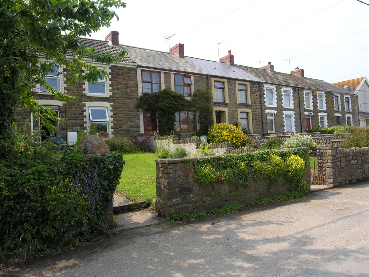
Most early housing for industrial labour, like that of the agricultural poor of the area, appears to have taken the form of cottages set on encroachment along the roadside margins. Throughout the post-medieval period industrial activity appears to have steadily increased, in particular in the area around Wernffrwd and Llanmorlais (more so around Crofty and Penclawdd to the east), with a number of pits being operated at Llanmorlais by Thomas Mansel, John Lucas and Gabriel Powell by the late eighteenth century; the rate of industrial growth was, however, not initially reflected in a corresponding growth in housing for the labour working the mines, and even as late as the latter half of the nineteenth century, the settlement at Llanmorlais comprised three cottages, housing colliers and fishermen, in addition to Llanmorlais Farm (Cooper 1998, 57-58). Major settlement expansion at Llanmorlais only appears following the arrival of the railway at Penclawdd in 1863, first with the development of Station Road, then expanding to include a range shops after 1886 and a post-office by 1911. More recent infilling and estate development around Llanmorlais has occurred, further altering the character of the settlement.