Gower
045 Horton
HLCA045 Horton
Post-medieval/medieval settlement and agricultural landscape and sub-manorial centre: varied fieldscape; organically clustered hamlet; post-medieval vernacular buildings; rural industry - extraction processing and rural crafts; and buried archaeology. Back to Map
Historic Background
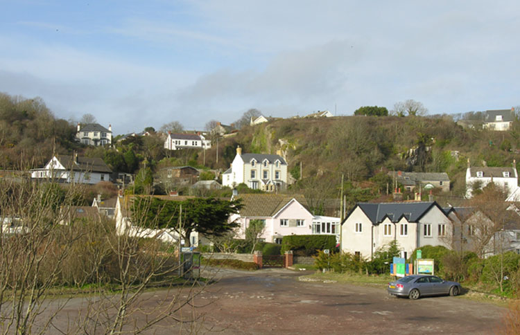
The historic landscape area of Horton represents the approximate extent of the former submanor of Horton encompassing the main settlement, which lies slightly north of the bay, together with the associated field system. The area borders the manor of Port Eynon to the west, Oxwich to the east and Scurlage to the north, and Penrice to the Northwest. Horton is largely designated as a conservation area (EV 9) in the Swansea Unitary Development Plan, with a narrow linear area of common land extending west and southeast of the settlement. To the south the area includes an area of coastal common, including an easterly extension of dune system fronting Port Eynon.
Little archaeological evidence is recorded for the area earlier than the medieval period other than two flint borers, one of which has been tentatively dated to the Palaeolithic. An unassigned cropmark enclosure (309485) noted on aerial photographs east of Moorcorner Farm may relate to occupation during the prehistoric period, but this needs further confirmation. Prehistoric find scatters from the general area form an increasing occurance and indicate a long history of landscape use.
During the medieval period the settlement of Horton initially formed part of the fief of Mounty Borough (later the fiefs of Penrice and Horton) held by the de Penres family (Draisey 2002, 19; Nicholl 1936,168-169). There are numerous land grants surviving from the period 1290-1320 most held in the Penrice and Margam Abbey mss. Sir Robert de Penres, several times commissioner of array on behalf of Edward II and lord of Penrice, appears to have sub-enfeoffed the fief of Horton to William of St Ishmaels prior to 1300 (Draisey 2002, 69).
During the post-medieval period the main landowner of the area continued to be the Penrice estate, by the eighteenth century in the hands of the Mansel-Talbot family. Documentary evidence suggests that the origins of the main post-medieval farmstead of the settlement, Great House, date at least to the sixteenth century, and the site may have had a medieval precursor. Great House was associated with the Lucas family during this period, and appears to have been used frequently as a 'dower house' until it became the main dwelling of the Lucas family of Horton and Port Eynon c.1703, following their abandoning of Salt House in Port Eynon (02189w). The buildings at Great House would appear to be eighteenth century in style; this would correspond to a rebuilding of the farmstead, undertaken once the site became the main dwelling of the family (RCAHMW 1988, 415).
The first edition 25-inch OS, 1879, shows settlement densely clustered around the junction of two north-south roads, little development is recorded in the 2nd OS map, 1898, or the 3rd in 1915, most occurs in the latter part of the twentieth century with infilling to the north and south of the area and the replacement of some existing cottages in the core of the area. Other more recent additions to the area are the various holiday camps, and a caravan site to the north of the settlement. The cottages and farmsteads of the settlement core mostly front onto the roads or minor lanes, though the pattern produced is generally haphazard. Both the 1785 estate plan and the first edition 25-inch OS map show the village dwellings are set within a matrix of irregularly evolved enclosures, which border the northern side of the linear, east - west aligned common. Other than Great House farm the main farmsteads at the time of the first edition OS survey appear to be Westernside, the Grange, and Bank Farm (now moved), all of which appear to be in the same form as shown on the estate plan of 1785. In addition the two ranges of farm buildings at Beeches Farm are also depicted, and two dwellings to the west, the nearest now known as Poplar Cottage. The Tucker family, noted for their active support of Weslyan Methodism since 1769, appear to have been associated with the holding from c.1741 and documentary evidence of the mid-1790s indicates a 'newly erected cottage', a long two-storey thatched building formed the dwelling of the Beeches at this date. Later in c.1870, the current farmhouse of Beeches (shown on the first edition 25-inch OS map) was built to the northeast (Nielson 1991).
A comparison between the eighteenth century estate plan, the 1st edition OS map and current maps would indicate that most of these farmsteads survive at least in plan. The possibility of interesting architectural survivals cannot be ruled out. A proportion of the area's smaller dwellings shown on the eighteenth century map also feature on the 1st edition map and appear to survive to this day in some form, including Ashtree Cottage, and possibly also the cottages known as Rock Cottage, Myrtle Cottage, Skysea Cottage, Briars Cottage and Hillcrest, though this can only be determined through further field investigation. The tithe map of c.1840and the first edition OS map depicts a few early nineteenth century additions such as Longcroft Cottage, Castle Hill Cottage, the Knoll, and Wesleyan Methodist Chapel, noted by Samuel Lewis in his Topographical Dictionary of 1833, and also its associated Manse.
Two further lanes extend south through the village, which then converge and diverge to allow access to both the common land along the western side of the escarpment, to the coastal littoral Common, and the sea. The lower settlement along towards the sea is a nineteenth century extension to the earlier settlement further upslope. Settlement here originated with the establishment of smallholdings from the early-19th century, including Swn-y-mor Cottage, the Gables, Shore Cottage, Robin's Rest, and Sunnybank (all depicted on the tithe map of c1840 and 1st edition 25-inch OS map), typically cottages set within or adjacent to one or two enclosures. Additional expansion to the east of Sunnybank is in place by the survey of the second edition OS, marked by Seabeach, Seabank, Sea Lodge and the Dingle (18559). Also of this period are the Hollies and Brig-y-don (later Talbot Lodge).
The associated fieldscape is little changed in terms of pattern since the first edition 25-inch OS, and indeed the estate plan of 1785, apart from minor amalgamation of enclosures. Remnants of the former medieval open field associated with the settlement of Horton is still discernable in the modern landscape, as fossilised linear strip field enclosures, accessed from the routes leading north from the settlement.
The quarrying and shipping of limestone, alongside inshore fishing and agriculture, and other rural craft/cottage industries provided employment for the inhabitants of Horton and the surrounding areas. There were at least two limekilns in the area of the linear common, including the now apparently destroyed site known as Kiln Bank (02465w), just south of the village centre. The limekiln to the west has an associated quarry named as old on the first edition 25-inch OS map; given the proximity of the coast, these features could be related to the coastal trade in limestone, as well as agricultural improvement to the surrounding land. The trade in quarried limestone from Gower came to an end by the close of the nineteenth century, because of the availability of other mass-produced fertilisers and the affects of rail travel on coastal shipping. By the publication of the second edition OS, only the disused kiln bank site is shown with its adjacent quarry.