Gower
030 The Vile
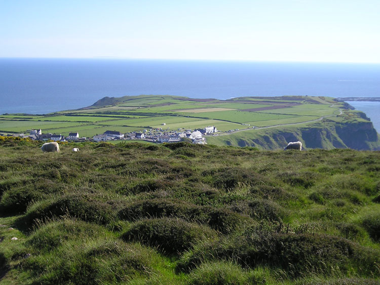
HLCA030 The Vile
Medieval/post-medieval agricultural landscape: relict medieval open field system; traditional enclosure boundaries; footpaths and tracks. Back to Map
Historic Background
The historic landscape area of The Vile is defined by the extent of well-preserved strip field system below Rhossili village on the very south-western tip of Gower before Worm's Head. Bounded to north, west and south by open marginal land (cliff edge) and to north-east by the road B4247.
Archaeological evidence in the area predating the medieval period is limited to only a few flint finds of unspecified prehistoric date (02096w; 02097w). An undated feature was noted on aerial photographs at the periphery of the area near Mewslade.
Although remnants of medieval strip fields are visible elsewhere in Gower, this area stands out as the only substantially relict example of a medieval strip field system surviving on the peninsular; indeed it is one of only a few areas remaining in the whole of Britain. As such its historical background is limited to the evolution and history of such a field system. The name The Vile stems from the old Gower pronunciation of 'field' (Lucas 2004); such fields were divided into a series of narrow strips known as landshares, separated by earthen banks. Each strip was individually owned and ownership could be of a number of strips scattered over the area as a way of sharing out the best soil between villagers; this would have been in combination with open access to grazing on the surrounding common land, in this case, Rhossili Down and the nearby cliff top common land. Commoner's rights also allowed grazing of livestock on The Vile in areas that were lying fallow at any time; this was also practiced after harvest when cattle grazed the remains of the crop (Emery 1974). This agricultural system is generally agreed to have been introduced by the Normans, however Kissock (1991, 41-3) argues that the open field at Rhossili was already a feature of the pre-Norman landscape.
The earliest record of management on the Vile dates to 1731, indicating a mixture of arable and communal grazing, regulated by agreement among the strip-holders (Emery 1975, 9-12). Analyses of map and documentary evidence by Davies (1956) revealed that in 1780, the strip-holders consisted of six farmers from Rhossili and seven from Middleton; the size of the holdings ranging from under an acre to 49 acres. There was virtually no change in the layout of the fields and banks between 1780 and 1845, with the holdings still being the same and occupied by the same families. Mapping of the area from 1780 onwards clearly shows the development of the fields into the form visible today. In 1780 it consisted of open fields running down the spine of the Worm's head peninsula. The peripheral areas, particularly that towards Mewslade Bay, had already been enclosed, but the underlying architecture of the strips could still be seen. A series of maps reproduced by Plunkett-Dillon and Latham (1986b) show the gradual enclosure of most of the remaining strips. This is particularly visible after 1948, with only a very small area in the middle of the west end of the area remaining unenclosed by 1976. From this time onwards fields have been made larger through amalgamation, however, this has been relatively limited and the original pattern is largely relict.
The field system could possibly have survived so substantially as the divisions may represent those laid out in a later period, possibly during the eighteenth century, following renewal and maintenance of original boundaries. Also given the remoteness of Rhossili right up until the beginning of the last century ensuring little change in agricultural practice and methods, with land remaining within the family through successive generations.