Gower
028 Hillend
HLCA028 Hillend
Post-medieval/medieval agricultural landscape: varied fieldscape superimposed over earlier field pattern; traditional boundaries; dispersed post-medieval settlement and related features. Back to Map
Historic Background
The historic landscape area of Hillend represents an area of enclosed land to the west end of Cefn Bryn Common. The area, with that taken by the core of the Fairy Hill Estate (minus the essential setting to the west of the Burry Stream), formed the detached part of the later medieval manor of Reynoldston. This area originally fell within the Welsh medieval Cwmwd of Gwyr, a subdivision of the Cantref of Eginog. During the reorganization of the post-medieval period the area formed part of the Hundred of Swansea, within the County of Glamorgan.
Reynoldston is listed as being an 'old knights fief' in a charter of 1306, however it is considered that this charter reflects the territorial ambitions of its sponsor, William de Breos VII, and is therefore suspect. It has been postulated that the manor of Reynoldston along with its detached part formed part of the sub-manor of Weobley, and part of the Lordship of Landimore (Nicholl 1936, 40). It is thought that during the pre-Norman early medieval period this area fell within the bounds of an extensive Welsh 'maenor', which comprised the western and northern limits of Gower.
The manor of Reynoldston is known to have been the property of the Vernons of Haddon Hall in Derbyshire from the 14th century until the death of Sir George Vernon in 1567. It passed by marriage to Sir Thomas Stanley of Tong, Shropshire and was then sold in 1574 to Sir Edward Herbert, the younger son of the 1st Earl of Pembroke (James 1983, 184).
Gabriel Powell's survey of the lordship of Gower in 1764, based on an updated survey of 1630 and 1665, informs us that the infant Thomas Mansel Talbot held the manor of Reynoldston. This and the earlier surveys detail the boundaries of the detached part of the manor, which follow the present community boundary.
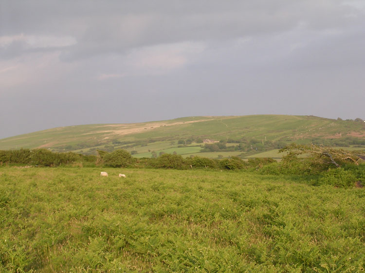
The extent of medieval agricultural exploitation in this area is as yet unknown, though the field pattern at Hillend Farm is slightly more regular than elsewhere and appears to mask an earlier medieval field system (00099w; 24319), now visible as ploughed-out banks and parchmarks. The general irregular evolved pattern of enclosures would suggest successive phases of encroachment along the edge of the common, eastwardly from Hillend to the boundary of the manor and parish. The present pattern of enclosure appears to be in place by the latter half of the eighteenth century at the latest. Little major difference is visible in terms of field pattern (where detailed) between that shown on an estate plan of 1785, the tithe of c.1840, the first edition 25-inch OS map of 1878, with only amalgamation of the smaller enclosures occurring during the twentieth century. Settlement distribution in the area, which is found at the junction between the enclosed land and the open common of Cefn Bryn, appears to have remained fairly constant, with only minimal loss represented by the now ruined agricultural dwelling of Little Hillend extant in the late eighteenth century.
The farmstead at Hillend is shown on the map of 1878 as a long range with a detached malthouse (possibly the former farmhouse as shown on the tithe map, which shows a cluster of smaller structures on the site) and minor outbuilding to the south within a matrix of small enclosures. To the east, Little Hillend, now ruinous, comprised a main range to the south with a smaller outbuilding to the north opposed across a central rectangular yard (little changed from the tithe). Single dispersed cottages with associated enclosures, or smallholdings, are depicted on both the tithe and the 1878 OS map along the south-eastern border of Cefn Bryn, including Henry's Well Cottages, Brook Cottage (18105), Frog Moor Cottage and what is now Fairy Lodge. Both the tithe and the 1878 map depict two buildings on the north side of the route from Burry Alley to Cefn Bryn; the eastern of the two located at a cross roads is a smithy; the near intact Coughlon's Forge (02121w; 41181), thought to be of early nineteenth century date.