Gower
013 Lower Rhossili Enclosed Coastal Strip
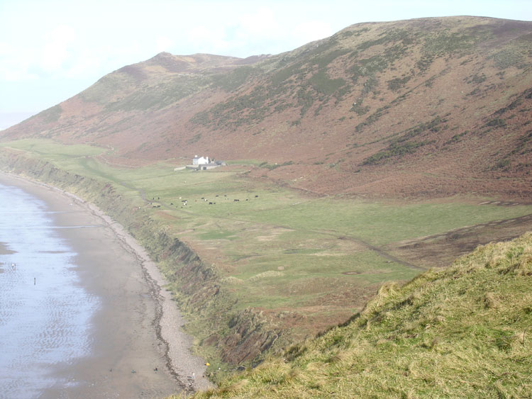
HLCA013 Lower Rhossili Enclosed Coastal Strip
Enclosed coastal margin and besanded landscape: relict archaeology; medieval settlement; and post-medieval fieldscape. Back to Map
Historic Background
The historic landscape area of Lower Rhossili Enclosed Coastal Strip covers the extent of enclosed land between the high watermark of Rhossili Bay as depicted on OS 1:10000 map and Rhossili Down. This is a narrow coastal strip north of Rhossili village to the burrows at Hillend and includes the deserted medieval settlement (SAM GM414; 15446; 01862w), Old Rectory (LB 22781 II) and associated glebe land. The full extent of the besanded settlement is unknown and therefore may extend beyond the boundaries of this character area.
References of the seventh to tenth century in the Book of Llandaff refer to two possible ecclesiastical estates considered to lie within the parish of Rhossili; the exact location of these estates is however, unknown and can only be conjectured. The western most estate is believed to be associated with the monastery of St. Cynwal (Llan Cyngualan). Confusion as to the exact monastic and ecclesiastical history of Rhossili arises from the presence of two churches; one in Rhossili Village (HLCA 031) (St Mary's) and the other (310526) located in this area and now covered by sand. Local tradition states that the doorway of the present church originally belonged to the besanded church giving it an earlier date than St Mary's; its Romanesque style dating to the twelfth century. Suggestions that this was an original lower village, which moved up the plateau as a result of sand deposition, are, however, unproven and it is possible that the two churches could have existed at the same time (Evans 1998). There is reference to 'Landimore Rossily the great and the lesse' in the translation of Rice Merrick's Morganniae Archaiographia (1983, 55), yet as there were two known estates this may refer to these, making the meaning of a Lower and Upper Village tenuous.
It is thought that this area became besanded in the fourteenth century, a time when many other places around the Gower coast met the same fate (e.g. HLCA 003, HLCA 009); evidence shows that this happened quickly and suddenly in this area. Excavations during the early 1980s revealed the church to be of Romanesque plan, this style dating it to c.1200 (Davidson and Davidson 1980). Wall paintings of red cinquefoils and black tendrils of fairly late date were discovered which indicate use of the church over a number of years. Occupational evidence from the area relates to the remains of a house, also excavated, and two middens containing food remains, a bone comb, an iron key and pottery dating to the 12th - 13th centuries (Davidson 1980).
The assertion that the besanded remains constitute a village is debatable given the limited excavation and identification of buildings. It is possible that this settlement may have been a monastic grange (Locock 1996), probably belonging to the Knights of St John along with rectory (LB 22781 II) and glebe (i.e. the terrace of enclosed land contained within this HLCA). However, hamlets listed under Rhossili parish by Rice Merrick include 'Down in Rhossili' which may indicate post-dissolution settlement of the rectory area and land north of that subject to besandment (Locock 1996). Geophysical survey of the area (Geophysical surveys of Bradford 1996) revealed the remains of further structures around both the church and Old Rectory. A cemetery connected with the church is attested by the exposure of a number of human remains in 1949 (Rutter 1949).
The Rectory (LB 22781 II) existing today was constructed c.1850 within an older enclosure. Its predecessor was described as 'two rooms upon a floor and lofted through, a barn and three small outhouses under one and the same roof' (LB description). There are ruins of other outbuildings in the vicinity. Declared uninhabitable by 1835, the earlier house was repaired and occupied by c.1840. No house is indicated on the tithe map of 1845, though the site is described as a parsonage. The field pattern remaining today remains little changed since the nineteenth century.