Historic Landscape
Characterisation
The Gwent Levels
04 Porton
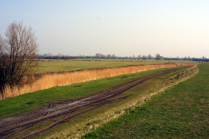
04 Porton character area: unusual "intermediate"
type landscape by the coast.
(Photo: GGAT Gwent Levels 030)
Click here for a character area map
This landscape appears to have been planned out in a single episode. Porton is documented from the mid thirteenth century.
Land in Porton was held by Goldcliff Priory and Tintern Abbey, though little documentation survives. There is a local legend that the original village has been eroded away; some claim the ghostly bells of Whitson church can still be heard.
Key historic landscape characteristics
Drainage features (reens, surface drainage, grip system), seawall,
rectangular fields in planned grid of roads, and network of green lanes,
fishery features (important Putcher rank)
This landscape is bounded by Whitson (area 3) to the north, Elver Pill Reen and Broadmead (area 7) to the east, Mireland Pill (area 1) to the west and the coast to the south.
The field pattern consists of rectangular fields set within a planned grid of roads. The axial east-west road may be an enclosed street common. The two north-south roads lack any waste and survive as unmetalled "green lanes". The hamlet of Porton lies adjacent to Whitson church, and includes a fine collection of seventeenth to eighteenth century buildings. The only other settlement is an isolated farmstead by the coast. It is known as "The Fisheries", and the remains of a "Putcher rank" can be seen in the intertidal zone.
The sea wall clearly cuts across the grain of this landscape, leading to the creation of a number of triangular shaped fields. Elver Pill (formerly Earls) Reen lies to the east; though documented from the sixteenth century, it is certainly much older. The sea wall has stone rubble facing and a wave return wall. Some well-preserved grips remain especially to the south. Some pollards are also in evidence.
It is unusual to find such a "regular landscape" so close to the coast, and is probably another example of medieval planning. It is a well preserved, very coherent landscape having a high group value, with a relatively intact field-boundary pattern, grip system and network of green lanes, all cut by the set-back sea wall.
To the south, hedges are mainly scrubby, with occasional mature willows. To the north, some boundaries have been lost, and many of the remaining hedges are well managed.
Overall, this is an extremely coherent landscape with a very high integrity;
the wide range of landscape elements articulate well. There are few visual
intrusions, apart from the British Steel pipeline down Elver Pill Reen
(though this is largely screened by hedges). The small hamlet at Porton
is particularly pleasant.